1. X
  2. NOAA's Ocean Service
Log inSign up
NOAA's Ocean Service
10.8K posts
user avatar
NOAA's Ocean Service
@noaaocean
We are the nation's premier federal science agency for the ocean and our coasts. An official @NOAA account: oceanservice.noaa.gov/socialmedia.htâ€Ķ
oceanservice.noaa.gov
Joined October 2008
268
Following
204.7K
Followers
RepliesRepliesMediaMedia

New to X?

Sign up now to get your own personalized timeline!

Create account

By signing up, you agree to the Terms of Service and Privacy Policy, including Cookie Use.

Terms·Privacy·Cookies·Accessibility·Ads Info·ÂĐ 2026 X Corp.
Don't miss what's happening
People on X are the first to know.
Log inSign up
  • user avatar
    NOAA's Ocean Service
    @noaaocean
    Sep 30, 2022
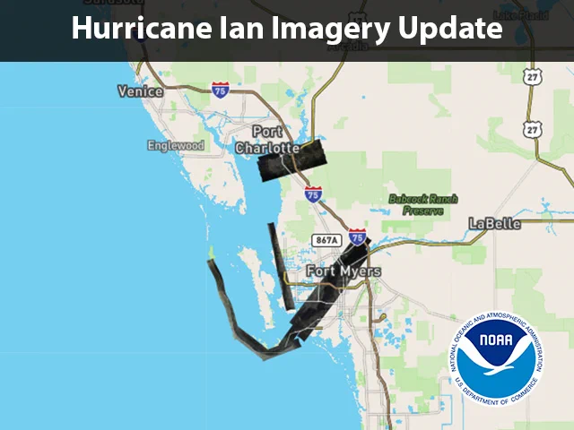
    We've started flying over communities affected by Hurricane Ian to assess the damage. Our first flight covered Punta Gorda and portions of Sanibel Island, Cape Coral, and the Caloosahatchee River up to I-75. The first images are available here: storms.ngs.noaa.gov/storms/ian/indâ€Ķ
    Map of the overflight area
  • user avatar
    NOAA's Ocean Service
    @noaaocean
    Oct 31, 2025
    NOAA is flying over over the area affected by Hurricane Melissa to support disaster response efforts in Jamaica. Find all the available imagery in our viewer: storms.ngs.noaa.gov/storms/melissaâ€Ķ
    Map of Jamaica indicating the areas where imagery is available
    458K
  • user avatar
    NOAA's Ocean Service
    @noaaocean
    Dec 24, 2021
    Did you know that coral reefs also have Christmas trees? Christmas tree worms, to be exact. oceanservice.noaa.gov/facts/xmas-treâ€Ķ
    Christmas tree worms on a coral reef.
  • user avatar
    NOAA's Ocean Service
    @noaaocean
    Apr 7, 2021
    For the first time, NOAA is launching a national rip current forecast model, aimed at saving lives of beach-goers around the country: oceanservice.noaa.gov/news/apr21/ripâ€Ķ #RipTides #BeachSafety @NWS
    Image shows a rip current using a harmless green dye.
  • user avatar
    NOAA's Ocean Service
    @noaaocean
    Nov 8, 2025
    Flights over the area affected by Hurricane Melissa have concluded. After just over 55 flight hours we were able to cover 4,075 square kilometers. Imagery from all flights is available here (select layers in the upper right to select specific flights or view MAXAR imagery):
    Map of Jamaica showing all the available imagery
    100K
  • user avatar
    NOAA's Ocean Service
    @noaaocean
    Apr 22, 2020
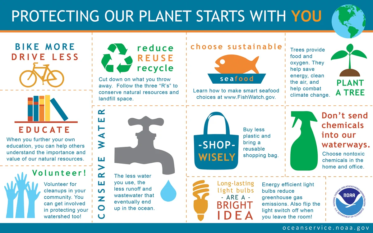
    Happy 50th birthday, Earth Day! Here are ten simple things you can do to help protect our planet as you celebrate: oceanservice.noaa.gov/ocean/earthdayâ€Ķ #EarthDayNOAA
    Infographic showing ten things you can do to protect the earth
  • user avatar
    NOAA's Ocean Service
    @noaaocean
    Nov 4, 2025
    Flights over the area affected by Hurricane Melissa continue, with the latest updates covering road corridors in support of search and rescue efforts. Imagery from all flights is available here (select layers in the upper right to select specific flights or view MAXAR imagery):
    Map of Jamaica indicated the areas of imagery (most of the southwestern corner and corridors across to the northern coast)
    62K
  • user avatar
    NOAA's Ocean Service
    @noaaocean
    Oct 9, 2024
    Water levels are starting to rise due to Hurricane #Milton at the Naples Bay and Fort Myers NOAA tide stations. View real-time water level and meteorological data at: tidesandcurrents.noaa.gov/inundationdb/câ€Ķ Find all NOAA's resources here: noaa.gov/milton Follow @FLSERT for life and
    Graph of water levels showing a sharp increase at Fort Myers
    Graph of water levels showing a sharp increase at Naples Bay
    147K
  • user avatar
    NOAA's Ocean Service
    @noaaocean
    Jun 8, 2023
    There are so many reasons why we should care about our ocean, on #WorldOceanDay and every day. Here are some of the many benefits to our planet: oceanservice.noaa.gov/facts/why-careâ€Ķ #OceanMonthNOAA
    infographic depicting stats on many benefits from the ocean. full text at link.
    50K
  • user avatar
    NOAA's Ocean Service
    @noaaocean
    Oct 1, 2022
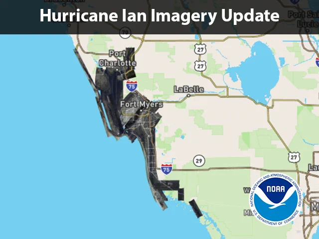
    We have just added additional imagery to the viewer. The latest update covers parts of Pine Island, Cape Coral, Belle Meade, Marco Island, and several communities around and including Everglades City. (1/3)
    map of the imaged area
  • user avatar
    NOAA's Ocean Service
    @noaaocean
    Jun 23, 2021
    Where is the Earth’s largest waterfall? You might be surprised to find out the answer: oceanservice.noaa.gov/facts/largest-â€Ķ #30DaysofOcean #OceanMonthNOAA #OceanMonth2021
    Infographic describing the world's largest waterfall. See URL link for full text.
  • user avatar
    NOAA's Ocean Service
    @noaaocean
    Dec 24, 2022
    Did you know that coral reefs also have Christmas trees? Christmas tree worms, to be exact. oceanservice.noaa.gov/facts/xmas-treâ€Ķ
    Photo of Christmas tree worms on a reef
    44K
  • user avatar
    NOAA's Ocean Service
    @noaaocean
    Mar 17, 2021
    Scientists used carbon dating to estimate the Greenland shark may live between 250 and 500 years. That means sharks alive today may have been around during New York City's first St. Patrick’s Day parade in the 1760s. oceanservice.noaa.gov/facts/greenlanâ€Ķ
    Greenland shark.
  • user avatar
    NOAA's Ocean Service
    @noaaocean
    Sep 28, 2022
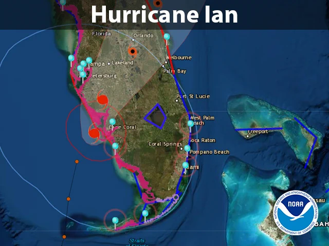
    Water levels in Naples, Florida have reached more than 6' above normal high tide ahead of #Ian's landfall of, eclipsing the station record of 4.25 feet set during Hurricane Irma in 2017. NOAA is continuing to monitor water levels throughout the region (1/2)
    Map of Florida overlaid with the track of the storm