Log InRegister
Search For:
Mineral Name:
Locality Name:
Keyword(s):
 
Home PageAbout MindatThe Mindat ManualHistory of MindatCopyright StatusWho We AreOur ScienceMindat Newsletter [Free Download]Contact Us
Donate to MindatSponsor a PageCorporate SponsorshipSponsored Pages
Learning CenterWhat Is a Mineral?The Most Common Minerals on EarthInformation for EducatorsMindat ArticlesMindat Newsletter [Free Download]The ElementsThe Mineral Quiz
Search FormMinerals by PropertiesMinerals by ChemistryMineral Visual ExplorerAdvanced Locality SearchRandom MineralRandom LocalitySearch by minIDMinerals by CountryAlphabetical Mineral IndexAlphabetical Locality SearchMineral Association SearchList of CountriesLocalities Near MePhoto SearchSearch ArticlesSearch GlossaryThe Rock H. Currier Digital LibraryMore Search Options
The Mindat ManualAdd a New PhotoRate PhotosLocality Edit ReportCoordinate Completion ReportAdd Glossary Item
MineralsPetrologyFossilsMeteoritesGeologic Time
Mining CompaniesStatisticsMineral MuseumsClubs & OrganizationsMineral Shows & EventsDevice SettingsTime Machine
Read DiscussionsIdentification Request
Photo SearchPhoto GalleriesSearch by ColourPhoto Colour ExplorerNew Photos TodayNew Photos YesterdayMembers' Photo GalleriesPast Photo of the Day GalleryPhotography

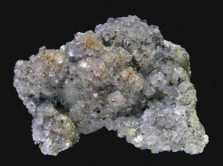
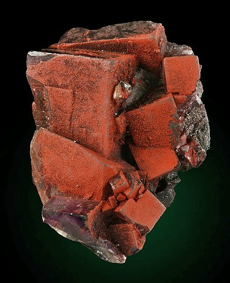
Fluorite from
Pea Ridge Mine, Washington County, Missouri, USA


Locality type:Mine
Classification
Species:Fluorite
Formula:CaF2
Confirmation
Validity:Believed Valid
Associated Minerals Based on Photo Data:
Chalcopyrite47
Hematite45
Calcite10
Baryte6
Quartz4
Data
Mineral Data:Click here to view Fluorite data
Locality Data:Click here to view Pea Ridge Mine, Washington County, Missouri, USA
Photo GalleryView Gallery (27 photos)
Data Identifiers
Mindat Occurrence Record ID:5318
Long-form Identifier:1:3:5318:1
GUID (UUID V4):0
Nearest other occurrences of Fluorite
17.8km (11.0 miles) ⓘBourbon Deposit (Bourbon Prospect), Crawford County, Missouri, USA
26.2km (16.3 miles) ⓘKratz Spring, Franklin County, Missouri, USA
44.1km (27.4 miles) ⓘCamels Hump (Czar Knob), Crawford County, Missouri, USA
55.0km (34.2 miles) ⓘBoss - Bixby Iron-copper deposit, Dent County, Missouri, USA
57.8km (35.9 miles) ⓘBell Mountain, Iron County, Missouri, USA
58.9km (36.6 miles) ⓘIron Mountain Mine, Iron Mountain, Iron Township, St. Francois County, Missouri, USA
59.6km (37.1 miles) ⓘSchnieder Quarry (Schnieder Granite Quarry), Graniteville, Iron County, Missouri, USA
60.1km (37.3 miles) ⓘSheahan Quarry, Graniteville, Iron County, Missouri, USA
60.9km (37.8 miles) ⓘMissouri Red Quarry, Graniteville, Iron County, Missouri, USA
67.1km (41.7 miles) ⓘPilot Knob Quarry, Pilot Knob, Iron County, Missouri, USA
References
 
and/or  
Mindat.org® is an outreach project of the Hudson Institute of Mineralogy, a 501(c)(3) not-for-profit organization. Mindat® and mindat.org® are registered trademarks of the Hudson Institute of Mineralogy.
Copyright © mindat.org and the Hudson Institute of Mineralogy 1993-2026, except where stated. Most political location boundaries are © OpenStreetMap contributors. Mindat.org relies on the contributions of thousands of members and supporters. Founded in 2000 by Jolyon Ralph and Ida Chau.
Content on this site may not be used to train, fine-tune, or otherwise develop artificial intelligence or machine learning models without prior written permission - see our Terms & Conditions.
To cite: Ralph, J., Von Bargen, D., Martynov, P., Zhang, J., Que, X., Prabhu, A., Morrison, S. M., Li, W., Chen, W., & Ma, X. (2025). Mindat.org: The open access mineralogy database to accelerate data-intensive geoscience research. American Mineralogist, 110(6), 833–844. doi:10.2138/am-2024-9486.
Privacy Policy - Terms & Conditions - Contact Us / DMCA issues - Report a bug/vulnerability Current server date and time: October 22, 2026 13:33:18
Go to top of page