







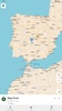
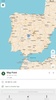





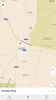
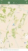

CoMaps is a free and open-source map and navigation app based on OpenStreetMap data. This app is developed by a community and offers offline navigation, privacy, and transparency, without any ads or the collection of personal data. You can use it to access offline maps, search for places, calculate walking, cycling, or driving routes, and check information related to points of interest even when you don't have Internet access.
Navigate without an Internet connection
One of the main objectives of CoMaps is the ability to use its map and navigation features without depending on a mobile connection. You will be able to download maps of whatever areas you need, then search for places, plan routes, and receive turn-by-turn GPS directions, which can be very helpful when traveling abroad or when you're in areas with limited coverage. The navigation feature also includes voiced guidance for walking, cycling, or driving.
Maps for city and nature
The maps include roads, walking paths, and bike lanes, as well as points of interest such as restaurants, gas stations, hotels, shops, and tourist attractions. It also features an outdoor activity-oriented mode that highlights hiking trails, campsites, water sources, peaks, and contour lines, so you can use the app both to get around the city and to plan your next hiking route. Furthermore, if you can't find the location you're looking for, you can create it yourself by tapping on the right spot on the map and adding whatever information you want to save.
Privacy as a priority
Privacy is a key part of CoMaps. The app does not identify individuals, does not track its users, and does not collect personal information. Furthermore, many of its features, including the search and offline navigation tools, can be used without sending data to external servers. The project also keeps its code open and publishes information about its development and funding.
My thoughts after trying CoMaps
Since CoMaps is focused on offline navigation, every time you search for something, the app offers you the option to download that area of the map so you can use it even when you don't have data. At first it's a bit strange, because you expect to start navigating right away, but once you've downloaded the areas you want, it's very easy to get around. From there, it starts working like a normal, everyday map, so you don't have to configure anything or make weird adjustments.
The best and worst of CoMaps
• What I like most is its offline navigation system and the number of car, bicycle, and hiking routes it includes.
• What I like least is that part of its operation depends on the data added to OpenStreetMap.
Download CoMaps's free APK to use offline maps, plan routes on foot, by bike, or by car, check out points of interest, and get around thanks to this privacy-focused, community-developed project.
CoMaps is for you if
✓ You need reliable offline maps and turn-by-turn navigation when traveling without mobile coverage
✓ You prioritize strong privacy, with no tracking, no ads, and transparent open-source development
✓ You enjoy versatile maps for driving, cycling, and outdoor adventures with detailed points of interest
Requirements (Latest version)
- Android 5.0 or higher required
































Comments
There are no opinions about CoMaps yet. Be the first! Comment