Log In


Mammoth Mine, Mount Gordon, Gunpowder District, City of Mount Isa, Queensland, Australiai
| Regional Level Types | |
|---|---|
| Mammoth Mine | Mine |
| Mount Gordon | Mountain |
| Gunpowder District | Mining District |
| City of Mount Isa | City |
| Queensland | State |
| Australia | Country |
This page is currently not sponsored. Click here to sponsor this page.



Latitude & Longitude (WGS84):
19° 41' 54'' South , 139° 21' 56'' East
Latitude & Longitude (decimal):
Type:
Köppen climate type:
Underground copper mine.
Copper oxide mineralisation was first discovered in the district at Mt Oxide in 1882, followed by the discovery of the Mammoth deposit by two Afghan cameleers, the Shah brothers in 1923. They worked the deposit as a small open cut from 1927. Between 1948 and 1969 the deposit was worked as a small-scale underground operation by Italo Foschi, who sank two shafts with three sub-levels. VAM Ltd, Consolidated Goldfields and Adelaide Brighton produced copper in concentrate and copper cathode from the Mammoth deposit between 1969 and 1995. Aberfoyle purchased the operation in 1995 and delineated the Esperanza deposit before being acquired by Western Metals Limited (“Western Metals”) in 1998, which commissioned the ferric leach plant that year to treat Esperanza ores. The Mammoth underground mine was reopened in late 2002.
Aditya Birla Minerals acquired the operations in November 2003 from receivers appointed for Western Metals.
Select Mineral List Type
Standard Detailed Gallery Strunz Chemical ElementsDetailed Mineral List:
| ⓘ Azurite Formula: Cu3(CO3)2(OH)2 References: |
| ⓘ Bornite Formula: Cu5FeS4 |
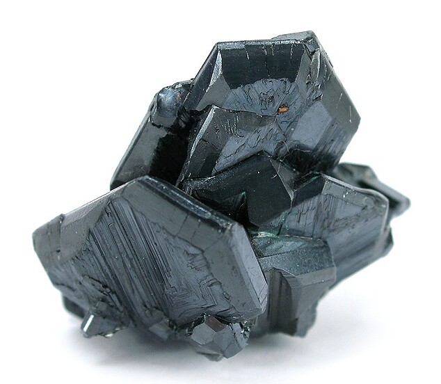
| ✪ Chalcocite Formula: Cu2S |
| ⓘ Chalcopyrite Formula: CuFeS2 References: |
| ⓘ 'Chlorite Group' References: |
| ⓘ Covellite Formula: CuS References: |
| ⓘ Digenite Formula: Cu9S5 |
| ⓘ Pyrite Formula: FeS2 References: |
| ⓘ Quartz Formula: SiO2 References: |
Gallery:

List of minerals arranged by Strunz 10th Edition classification
| Group 2 - Sulphides and Sulfosalts | |||
|---|---|---|---|
| ⓘ | Chalcocite | 2.BA.05 | Cu2S |
| ⓘ | Digenite | 2.BA.10 | Cu9S5 |
| ⓘ | Bornite | 2.BA.15 | Cu5FeS4 |
| ⓘ | Covellite | 2.CA.05a | CuS |
| ⓘ | Chalcopyrite | 2.CB.10a | CuFeS2 |
| ⓘ | Pyrite | 2.EB.05a | FeS2 |
| Group 4 - Oxides and Hydroxides | |||
| ⓘ | Quartz | 4.DA.05 | SiO2 |
| Group 5 - Nitrates and Carbonates | |||
| ⓘ | Azurite | 5.BA.05 | Cu3(CO3)2(OH)2 |
| Unclassified | |||
| ⓘ | 'Chlorite Group' | - | |
List of minerals for each chemical element
| H | Hydrogen | |
|---|---|---|
| H | ⓘ Azurite | Cu3(CO3)2(OH)2 |
| C | Carbon | |
| C | ⓘ Azurite | Cu3(CO3)2(OH)2 |
| O | Oxygen | |
| O | ⓘ Azurite | Cu3(CO3)2(OH)2 |
| O | ⓘ Quartz | SiO2 |
| Si | Silicon | |
| Si | ⓘ Quartz | SiO2 |
| S | Sulfur | |
| S | ⓘ Bornite | Cu5FeS4 |
| S | ⓘ Chalcopyrite | CuFeS2 |
| S | ⓘ Chalcocite | Cu2S |
| S | ⓘ Covellite | CuS |
| S | ⓘ Digenite | Cu9S5 |
| S | ⓘ Pyrite | FeS2 |
| Fe | Iron | |
| Fe | ⓘ Bornite | Cu5FeS4 |
| Fe | ⓘ Chalcopyrite | CuFeS2 |
| Fe | ⓘ Pyrite | FeS2 |
| Cu | Copper | |
| Cu | ⓘ Azurite | Cu3(CO3)2(OH)2 |
| Cu | ⓘ Bornite | Cu5FeS4 |
| Cu | ⓘ Chalcopyrite | CuFeS2 |
| Cu | ⓘ Chalcocite | Cu2S |
| Cu | ⓘ Covellite | CuS |
| Cu | ⓘ Digenite | Cu9S5 |
Other Regions, Features and Areas containing this locality
Australia
- North Australian ElementCraton
- Queensland
- Mount Isa OrogenOrogen
- Leichhardt River DomainDomain
- Mount Isa OrogenOrogen
Australian PlateTectonic Plate
- North Australian Craton
- Mount Isa ProvinceShield
This page contains all mineral locality references listed on mindat.org. This does not claim to be a complete list. If you know of more minerals from this site, please register so you can add to our database. This locality information is for reference purposes only. You should never attempt to
visit any sites listed in mindat.org without first ensuring that you have the permission of the land and/or mineral rights holders
for access and that you are aware of all safety precautions necessary.

Mammoth Mine, Mount Gordon, Gunpowder District, City of Mount Isa, Queensland, Australia