Log In


Pilbara Region, Western Australia, Australiai
| Regional Level Types | |
|---|---|
| Pilbara Region | Region |
| Western Australia | State |
| Australia | Country |
This page is currently not sponsored. Click here to sponsor this page.

Latitude & Longitude (WGS84):
21° 35' 31'' South , 121° 31' 25'' East
Latitude & Longitude (decimal):
Type:
Köppen climate type:
A large (around 505,000 square km) region in the North of Western Australia.
It hosts important iron ore deposits as well as granite pegmatites.
Within the Pilbara are the Shires of Ashburton, East Pilbara, Roebourne and the town and shire of Port Hedland.
Dec 2012- Listings on Mindat for Western Australia have been changed from regions to local government entities known as shires.
For reference purposes, listings for the major regions of the Kimberley, Pilbara, Gascoyne, Mid-West, Goldfields, Nullabor, South-West and the Interior have been retained.
The Pilbara Region is found in the north-west of the State of Western Australia. It can be roughly determined by drawing a north-south line from the coast, half-way between Port Hedland and Broome. The southern boundary, the Tropic of Capricorn can be used, although to be exact some locations falling within 50 kilometres south of this line could be considered part of the Pilbara.
Most of the region is hilly or mountainous, with the Hamersley Ranges forming the highest points in the central part of the region.
The Pilbara Region contains the following shires: Ashburton Shire, the far northern portion of the Carnarvon Shire, the western half of the East Pilbara Shire, Exmouth Shire, Port Hedland Shire, and the Roebourne Shire.
Major towns in the region include Exmouth, Karratha, Marble Bar, Newman, Nullagine, Pananwonica, Paraburdoo, Port Hedland, Roebourne, and Tom Price.
The region contains several major iron ore mines in the central-southern and western portions. Gold, lead, manganese, and copper are mined mainly in the eastern portion of the region. There are extensive natural gas fields off the coast.
Sub-regions which may be labelled on specimens include Hamersley Ranges, Chichester Ranges, West Pilbara, East Pilbara, widespread geological features such as named Banded Iron Formations.
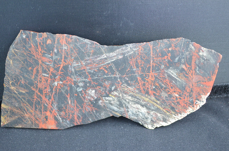
Notable mineral localities are spread throughout the entire region, with possibly the exception of the far west near Exmouth. They include Bali Lo at the southern extremity of the region in the Capricorn Ranges; Whim Creek near the coast between Roebourne and Port Hedland; Otway Ni Prospect just north of Nullagine; Elizabeth Hill south of Karratha; Tiger Iron from the Ord Ranges east of Port Hedland; Tiger Eye from Marra Mamba in the central Hamersley Ranges; several jasper localities mainly Chichester Ranges and Marillana Station.
Mindat contains a large number of entries for the Marble Bar area, mostly small mines and prospects. In an attempt to organise these, outlying areas have been listed as Bamboo Creek District, Gregory Ranges District, Rippon Hills District, Rudall River District, and Shaw River District.
Select Mineral List Type
Standard Detailed Gallery Strunz Chemical ElementsDetailed Mineral List:
| ⓘ Bobierrite Formula: Mg3(PO4)2 · 8H2O |
| ⓘ Hematite Formula: Fe2O3 References: |
| ⓘ Hematite var. Martite Formula: Fe2O3 References: |
| ⓘ Native Gold Formula: Au References: |
Gallery:
List of minerals arranged by Strunz 10th Edition classification
| Group 1 - Elements | |||
|---|---|---|---|
| ⓘ | Native Gold | 1.AA.05 | Au |
| Group 4 - Oxides and Hydroxides | |||
| ⓘ | Hematite | 4.CB.05 | Fe2O3 |
| ⓘ | var. Martite | 4.CB.05 | Fe2O3 |
| Group 8 - Phosphates, Arsenates and Vanadates | |||
| ⓘ | Bobierrite | 8.CE.35 | Mg3(PO4)2 · 8H2O |
List of minerals for each chemical element
| H | Hydrogen | |
|---|---|---|
| H | ⓘ Bobierrite | Mg3(PO4)2 · 8H2O |
| O | Oxygen | |
| O | ⓘ Bobierrite | Mg3(PO4)2 · 8H2O |
| O | ⓘ Hematite | Fe2O3 |
| O | ⓘ Hematite var. Martite | Fe2O3 |
| Mg | Magnesium | |
| Mg | ⓘ Bobierrite | Mg3(PO4)2 · 8H2O |
| P | Phosphorus | |
| P | ⓘ Bobierrite | Mg3(PO4)2 · 8H2O |
| Fe | Iron | |
| Fe | ⓘ Hematite | Fe2O3 |
| Fe | ⓘ Hematite var. Martite | Fe2O3 |
| Au | Gold | |
| Au | ⓘ Native Gold | Au |
Other Regions, Features and Areas containing this locality
Australian PlateTectonic Plate
- Muscgrave RangesOrogenic Belt
This page contains all mineral locality references listed on mindat.org. This does not claim to be a complete list. If you know of more minerals from this site, please register so you can add to our database. This locality information is for reference purposes only. You should never attempt to
visit any sites listed in mindat.org without first ensuring that you have the permission of the land and/or mineral rights holders
for access and that you are aware of all safety precautions necessary.

Pilbara Region, Western Australia, Australia