Log In


Harding Springs, Ambalindum Station, Harts Range, Central Desert Region, Northern Territory, Australiai
| Regional Level Types | |
|---|---|
| Harding Springs | Group of Springs |
| Ambalindum Station | - not defined - |
| Harts Range | Mountain Range |
| Central Desert Region | Region |
| Northern Territory | Territory |
| Australia | Country |
This page is currently not sponsored. Click here to sponsor this page.
Get Involved with mindat.org
Mindat.org has grown through countless contributions from mineral enthusiasts, collectors, researchers and experts around the world — people just like you.
Want to take part?
1
2
3
4
Contribute
Add photos, locality information and knowledge
Every contribution helps make mindat.org better for everyone.


Latitude & Longitude (WGS84):
23° 16' 1'' South , 135° 9' 58'' East
Latitude & Longitude (decimal):
Type:
Group of Springs
Köppen climate type:
An area with many different types of mineral localities.
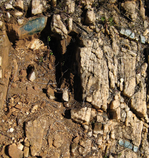
Located in the southern part of what is called the Entia Valley. Photographs on Mindat show aquamarine, clear, smoky and amethyst quartz crystals and sceptres, and chrysoberyl. These photographs are mainly by Patrick Gundersen, who uncovered the specimens from un-named pegmatites, in remote areas in the district. The Carrara mica mines are about 9 kilometres north-west of the Harding Springs location, containing muscovite, beryl, garnet, ilmenite, epidote, microcline, and amazon stone. No access track could be seen into these locations.
There are several ways to access the Harding Springs locations. It should be remembered that Harding Springs is located on a cattle station and permission should be sought before accessing.
1. One way is to contact the Ambalindum Station, and book into their accommodation. The homestead is 58 kilometres by station tracks south-west of the location. Then book a fossicking tour, where participants drive their own 4 wheel drive to a prospectors shack near Mount George, and are taken to a couple of selected sites to fossick. Permission to wander across the countryside looking for undiscovered treasures may not be given.
2. Another is accessing from the Plenty Highway. At the time of writing (2017) travellers will come across signs from the station threatening to prosecute anyone with trespass. Just after the Entire Creek crossing on the Plenty Highway, head on a track south. Go 22.7 kilometres south to Inkamulla Well. Take the track east approximately 15 kilometres, then the right fork south. The track crosses the wide Huckitta Creek, turn briefly east, then south again, reaching the Quartz Hill cattle yards a total of 31.4 kilometres from Inkamulla Well. Go a further 3.7 kilometres south to Coggan Bore. Opposite the bore, take the track south-west, which then heads west to Harding Springs a total of 22.5 kilometres from Coggan Bore.
3. At Inkamulla Well above take the track west 12.1 kilometres to Spriggs Creek Bore. This will require a crossing of the creek just before the bore. Take the track south south-west 27 kilometres, until a track heading west to the homestead is reached. Remain on the track that turns east for another 16.7 kilometres.
Harding Springs is nothing more than a well and cattle yard. A house, possibly the prospectors shack mentioned above is 4.3 kilometres west of Harding Springs, and one kilometre north of the track along a fence line. Availability of water in the district is not guaranteed, as wells can remain on maps long after they become derelict. Neither is there a guarantee the shack will be occupied. The area is remote, mountainous, largely waterless, with no help nearby.
Select Mineral List Type
Standard Detailed Gallery Strunz Chemical ElementsDetailed Mineral List:
| ⓘ 'Apatite' Formula: Ca5(PO4)3A |
| ⓘ Beryl Formula: Be3Al2(Si6O18) References: |
| ⓘ Beryl var. Aquamarine References: |
| ⓘ Chrysoberyl Formula: BeAl2O4 |
| ⓘ Muscovite Formula: KAl2(AlSi3O10)(OH)2 |
| ⓘ Quartz Formula: SiO2 References: |
| ⓘ Quartz var. Amethyst Formula: SiO2 References: |
| ⓘ Quartz var. Smoky Quartz Formula: SiO2 References: |

List of minerals arranged by Strunz 10th Edition classification
| Group 4 - Oxides and Hydroxides | |||
|---|---|---|---|
| ⓘ | Chrysoberyl | 4.BA.05 | BeAl2O4 |
| ⓘ | Quartz var. Amethyst | 4.DA.05 | SiO2 |
| ⓘ | 4.DA.05 | SiO2 | |
| ⓘ | var. Smoky Quartz | 4.DA.05 | SiO2 |
| Group 9 - Silicates | |||
| ⓘ | Beryl var. Aquamarine | 9.CJ.05 | Be3Al2(Si6O18) |
| ⓘ | 9.CJ.05 | Be3Al2(Si6O18) | |
| ⓘ | Muscovite | 9.EC.15 | KAl2(AlSi3O10)(OH)2 |
| Unclassified | |||
| ⓘ | 'Apatite' | - | Ca5(PO4)3A |
List of minerals for each chemical element
| H | Hydrogen | |
|---|---|---|
| H | ⓘ Muscovite | KAl2(AlSi3O10)(OH)2 |
| Be | Beryllium | |
| Be | ⓘ Beryl | Be3Al2(Si6O18) |
| Be | ⓘ Chrysoberyl | BeAl2O4 |
| O | Oxygen | |
| O | ⓘ Quartz var. Amethyst | SiO2 |
| O | ⓘ Beryl | Be3Al2(Si6O18) |
| O | ⓘ Chrysoberyl | BeAl2O4 |
| O | ⓘ Muscovite | KAl2(AlSi3O10)(OH)2 |
| O | ⓘ Quartz | SiO2 |
| O | ⓘ Quartz var. Smoky Quartz | SiO2 |
| O | ⓘ Apatite | Ca5(PO4)3A |
| Al | Aluminium | |
| Al | ⓘ Beryl | Be3Al2(Si6O18) |
| Al | ⓘ Chrysoberyl | BeAl2O4 |
| Al | ⓘ Muscovite | KAl2(AlSi3O10)(OH)2 |
| Si | Silicon | |
| Si | ⓘ Quartz var. Amethyst | SiO2 |
| Si | ⓘ Beryl | Be3Al2(Si6O18) |
| Si | ⓘ Muscovite | KAl2(AlSi3O10)(OH)2 |
| Si | ⓘ Quartz | SiO2 |
| Si | ⓘ Quartz var. Smoky Quartz | SiO2 |
| P | Phosphorus | |
| P | ⓘ Apatite | Ca5(PO4)3A |
| K | Potassium | |
| K | ⓘ Muscovite | KAl2(AlSi3O10)(OH)2 |
| Ca | Calcium | |
| Ca | ⓘ Apatite | Ca5(PO4)3A |
Other Regions, Features and Areas containing this locality
Australia
- Arunta OrogenOrogen
- Aileron ProvinceGeologic Province
- North Australian ElementCraton
- Northern Territory
- Kalkarindji Igneous ProvinceGeologic Province
Australian PlateTectonic Plate
- Arunta BlockOrogenic Belt
This page contains all mineral locality references listed on mindat.org. This does not claim to be a complete list. If you know of more minerals from this site, please register so you can add to our database. This locality information is for reference purposes only. You should never attempt to
visit any sites listed in mindat.org without first ensuring that you have the permission of the land and/or mineral rights holders
for access and that you are aware of all safety precautions necessary.

Harding Springs, Ambalindum Station, Harts Range, Central Desert Region, Northern Territory, Australia