Log In


Eagle Picher Mine, Creta, Jackson County, Oklahoma, USAi
| Regional Level Types | |
|---|---|
| Eagle Picher Mine | Mine |
| Creta | - not defined - |
| Jackson County | County |
| Oklahoma | State |
| USA | Country |
This page is currently not sponsored. Click here to sponsor this page.
Latitude & Longitude (WGS84):
34° 31' North , 99° 33' West
Latitude & Longitude (decimal):
Type:
Köppen climate type:
Other/historical names associated with this locality:
Creta deposit
A Cu-Ag occurrence/mine located in secs. 3, 4, 9, 10, 15, and 16, T1S, R22W, Indian Meridian, on private land. Discovered in 1962 by Kenneth E. Smith, formerly of Vinson, Harmon County, Oklahoma. Captain R.B. Marcy noted copper in the region as early as 1852. Owned & operated by Eagle-Picher Industries Incorporated (100%), Oklahoma (1962-1978). Owned by Mr. Ira C.Prewitt and others (in T1S, R22W). Operated by EP Minerals, LLC Reno, Nevada. Operated during the period 1965-1975. The USGS MRDS database stated accuracy for this location is 10 meters.
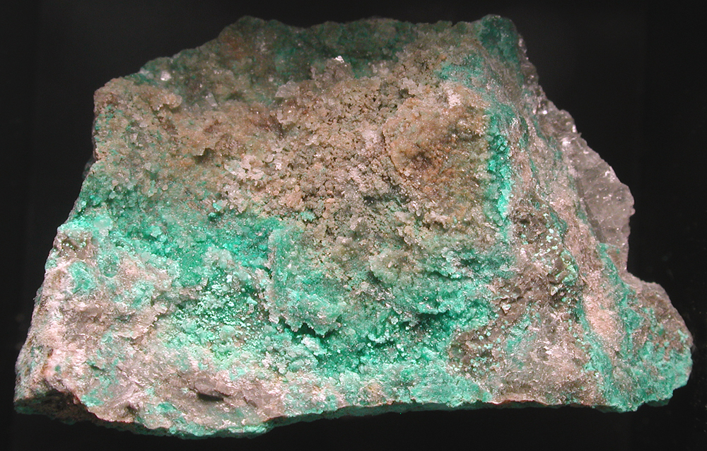
Mineralization is a Cu-Ag deposit (Mineral occurrence model information: Model code: 197; USGS model code: 30b; BC deposit profile: E04; Deposit model name: Sediment-hosted Cu; Mark3 model number: 63), hosted in the Permian Prewitt Copper Shale and Upper Copper Shale. The ore body strikes NNW and is sedimentary, tabular and disseminated, at 0.27 meter thick, a width of 2.5 meters (?), and a length of 11,265.1 meters. The depth-to-top is 13.5 meters with a minimum of 4.5 meters. The primary mode of origin was residual concentration. Primary ore control was bedding and the secondary control was lithology. Malachite is oxidized from chalcocite where there is less than 10-15 feet of overburden. Associated rocks include the Permian Flowerpot Shale. Local rocks include the Elm Fork Member of Blaine Formation.
Regional geologic structures include low westward dip of about 10-20 feet/mile WSW.
Workings include surface openings comprised of strip operations. They have a length of 8,046.5 meters, width of 3,218.6 meters with an overall depth of 30.48 meters, overall length of 11,265.1 meters and an overall width of 4,827.9 meters.
Production statistics: Approximately 40,000 tons of Cu were recovered, at $0.75 cents/pound, or $1,500/ton, or $60,000,000 total (period values). About $1,600,000 (period values) in Ag was recovered (4 ounces/ton of concentrates or 80,000 X 4 X $5.00 = $1,600,000).
Commodity: To the south, these beds were commercially mined beginning in sept. 1965 by eagle-picher industries, inc., at the rate of about 1000 tons of ore a day. The deposits extend over an area of 15 square miles in 1s-22w. By aug. 1973, about 1.5 million tons of ore was mined, with average grade of 1.9% cu. The ore was dried in a mill and floated, to produce a concentrate of 50% cu, which was shipped to the asarco copper smelter in el paso, texas. Mining ceased on feb. 23, 1975, and the mill closed on march 28, 1975, due to low copper prices of 63 cents a pound. Total production was 2,000,000 tons of ore. The prewitt copper shale averaged 1.9% cu after mining 1.5 million tons, according to dingess (1976, p. 16). About 2,000,000 tons were mined. About 4,000,000 tons are unmined, with average of 0.5% of 6 inch bed of prewitt copper shale, over 10 square miles left. About 5 square miles were mined.
Deposit: Johnson (1962) gives details. Ham and johnson (1964, p. 28, sec. A) published details. Richter (1960) mapped the geology of the area. Johnson (1976), dingess (1976), hagni and gann (1976), lockwood (1972; 1976), kidwell and bower (1976), johnson and brockie (1973), and stroud and others (1970) discuss the mineralogy and economic geology of the area. About 2,000,000 tons of ore was mined from the prewitt copper shale, with average content of 1.9% cu. The concentrate was 50% cu, with 3-5 oz/ton of Ag (silver).
Deposit type: Sediment-hosted Cu
Development: Mr. Smith brought in samples from ne-nw-15-1s-22 W in early 1962. Ham and johnson began studies in march 1962. Eagle-picher began studies in summer 1963, beginning mining in sept. 1965, and closed feb. 23, 1975, due to depressed economics. About 2,000,000 tons was mined. About 2,000,000 tons or more remains, with average of 1.9% cu, and 30-100 ft of overburden. Mr. Smith brought samples to ogs from ne-nw-15-1s-22w, in january or february 1962. Ken johnson began measuring sections on march 6, 1962, working with william ham. Eagle-picher began studies in summer 1963. Ham and johnson published in 1964. Eagle-picher began mining in september 1965 and closed february 23, 1975, due to bad economics.
Geology: Alteration: malachite is oxidized from chalcocite where less than 10-15 ft of overburden host rock unit name - prewitt copper shale and upper copper shale, 5-10 ft below marty dol. The marty dol. Is about 25-30 ft below the haystack gypsum. The copper shales are 0.25-1 ft thick in several beds, about 5-10 ft below the marty dol. The grade of copper is 0.2-4.5%, with an average of 1.9% for the prewitt copper shale. The upper copper shale was locally mined in the northern part of 1s-22w, with an average grade of 0.79% cu, being about 5 inches thick.; hr.age.mv: guadalupian prewitt copper shale, 9.7 ft below marty dolomite; upper copper shale, 5.3 ft below marty dolomite. The marty dolomite is about 25-30 ft below the haystack gypsum. The flowerpot is about 154 ft thick. The prewitt copper shale is the main ore body, about 0.25-1.5 ft thick, averaging 1.9% cu. It occurs over 15 square miles. About 5 square miles were mined. A cap gypsum, about 1 ft thick, occurs at the top of the prewitt, about 8.7 ft below marty dolomite.;
Select Mineral List Type
Standard Detailed Gallery Strunz Chemical ElementsCommodity List
This is a list of exploitable or exploited mineral commodities recorded at this locality.Mineral List
20 valid minerals.
Rock Types Recorded
Note: data is currently VERY limited. Please bear with us while we work towards adding this information!
Select Rock List Type
Alphabetical List Tree DiagramDetailed Mineral List:
| ⓘ Anilite Formula: Cu7S4 |
| ⓘ Azurite Formula: Cu3(CO3)2(OH)2 References: |
| ⓘ Baryte Formula: BaSO4 References: |
| ⓘ Bornite Formula: Cu5FeS4 |
| ⓘ Botallackite Formula: Cu2(OH)3Cl References: |
| ⓘ Brochantite Formula: Cu4(SO4)(OH)6 References: |
| ⓘ Callaghanite Formula: Cu2Mg2(CO3)(OH)6 · 2H2O References: |
| ⓘ Chalcocite Formula: Cu2S References: |
| ⓘ Chalcopyrite Formula: CuFeS2 |
| ⓘ Covellite Formula: CuS References: |
| ⓘ Cuprite ? Formula: Cu2O References: |
| ⓘ Digenite Formula: Cu9S5 |
| ⓘ Djurleite Formula: Cu31S16 |
| ⓘ Dolomite Formula: CaMg(CO3)2 |
| ⓘ Galena Formula: PbS References: |
| ⓘ Gypsum Formula: CaSO4 · 2H2O Description: Haystack Gypsum. |
| ⓘ Malachite Formula: Cu2(CO3)(OH)2 References: |
| ⓘ Native Silver Formula: Ag References: |
| ⓘ Pyrite Formula: FeS2 References: |
| ⓘ Stromeyerite Formula: AgCuS |
Gallery:
List of minerals arranged by Strunz 10th Edition classification
| Group 1 - Elements | |||
|---|---|---|---|
| ⓘ | Native Silver | 1.AA.05 | Ag |
| Group 2 - Sulphides and Sulfosalts | |||
| ⓘ | Chalcocite | 2.BA.05 | Cu2S |
| ⓘ | Djurleite | 2.BA.05 | Cu31S16 |
| ⓘ | Anilite | 2.BA.10 | Cu7S4 |
| ⓘ | Digenite | 2.BA.10 | Cu9S5 |
| ⓘ | Bornite | 2.BA.15 | Cu5FeS4 |
| ⓘ | Stromeyerite | 2.BA.40 | AgCuS |
| ⓘ | Covellite | 2.CA.05a | CuS |
| ⓘ | Chalcopyrite | 2.CB.10a | CuFeS2 |
| ⓘ | Galena | 2.CD.10 | PbS |
| ⓘ | Pyrite | 2.EB.05a | FeS2 |
| Group 3 - Halides | |||
| ⓘ | Botallackite | 3.DA.10b | Cu2(OH)3Cl |
| Group 4 - Oxides and Hydroxides | |||
| ⓘ | Cuprite ? | 4.AA.10 | Cu2O |
| Group 5 - Nitrates and Carbonates | |||
| ⓘ | Dolomite | 5.AB.10 | CaMg(CO3)2 |
| ⓘ | Azurite | 5.BA.05 | Cu3(CO3)2(OH)2 |
| ⓘ | Malachite | 5.BA.10 | Cu2(CO3)(OH)2 |
| ⓘ | Callaghanite | 5.DA.25 | Cu2Mg2(CO3)(OH)6 · 2H2O |
| Group 7 - Sulphates, Chromates, Molybdates and Tungstates | |||
| ⓘ | Baryte | 7.AD.35 | BaSO4 |
| ⓘ | Brochantite | 7.BB.25 | Cu4(SO4)(OH)6 |
| ⓘ | Gypsum | 7.CD.40 | CaSO4 · 2H2O |
List of minerals for each chemical element
| H | Hydrogen | |
|---|---|---|
| H | ⓘ Azurite | Cu3(CO3)2(OH)2 |
| H | ⓘ Botallackite | Cu2(OH)3Cl |
| H | ⓘ Brochantite | Cu4(SO4)(OH)6 |
| H | ⓘ Callaghanite | Cu2Mg2(CO3)(OH)6 · 2H2O |
| H | ⓘ Gypsum | CaSO4 · 2H2O |
| H | ⓘ Malachite | Cu2(CO3)(OH)2 |
| C | Carbon | |
| C | ⓘ Azurite | Cu3(CO3)2(OH)2 |
| C | ⓘ Callaghanite | Cu2Mg2(CO3)(OH)6 · 2H2O |
| C | ⓘ Dolomite | CaMg(CO3)2 |
| C | ⓘ Malachite | Cu2(CO3)(OH)2 |
| O | Oxygen | |
| O | ⓘ Azurite | Cu3(CO3)2(OH)2 |
| O | ⓘ Baryte | BaSO4 |
| O | ⓘ Botallackite | Cu2(OH)3Cl |
| O | ⓘ Brochantite | Cu4(SO4)(OH)6 |
| O | ⓘ Callaghanite | Cu2Mg2(CO3)(OH)6 · 2H2O |
| O | ⓘ Cuprite | Cu2O |
| O | ⓘ Dolomite | CaMg(CO3)2 |
| O | ⓘ Gypsum | CaSO4 · 2H2O |
| O | ⓘ Malachite | Cu2(CO3)(OH)2 |
| Mg | Magnesium | |
| Mg | ⓘ Callaghanite | Cu2Mg2(CO3)(OH)6 · 2H2O |
| Mg | ⓘ Dolomite | CaMg(CO3)2 |
| S | Sulfur | |
| S | ⓘ Anilite | Cu7S4 |
| S | ⓘ Baryte | BaSO4 |
| S | ⓘ Bornite | Cu5FeS4 |
| S | ⓘ Brochantite | Cu4(SO4)(OH)6 |
| S | ⓘ Chalcopyrite | CuFeS2 |
| S | ⓘ Chalcocite | Cu2S |
| S | ⓘ Covellite | CuS |
| S | ⓘ Digenite | Cu9S5 |
| S | ⓘ Djurleite | Cu31S16 |
| S | ⓘ Galena | PbS |
| S | ⓘ Gypsum | CaSO4 · 2H2O |
| S | ⓘ Pyrite | FeS2 |
| S | ⓘ Stromeyerite | AgCuS |
| Cl | Chlorine | |
| Cl | ⓘ Botallackite | Cu2(OH)3Cl |
| Ca | Calcium | |
| Ca | ⓘ Dolomite | CaMg(CO3)2 |
| Ca | ⓘ Gypsum | CaSO4 · 2H2O |
| Fe | Iron | |
| Fe | ⓘ Bornite | Cu5FeS4 |
| Fe | ⓘ Chalcopyrite | CuFeS2 |
| Fe | ⓘ Pyrite | FeS2 |
| Cu | Copper | |
| Cu | ⓘ Anilite | Cu7S4 |
| Cu | ⓘ Azurite | Cu3(CO3)2(OH)2 |
| Cu | ⓘ Bornite | Cu5FeS4 |
| Cu | ⓘ Botallackite | Cu2(OH)3Cl |
| Cu | ⓘ Brochantite | Cu4(SO4)(OH)6 |
| Cu | ⓘ Callaghanite | Cu2Mg2(CO3)(OH)6 · 2H2O |
| Cu | ⓘ Chalcopyrite | CuFeS2 |
| Cu | ⓘ Chalcocite | Cu2S |
| Cu | ⓘ Covellite | CuS |
| Cu | ⓘ Cuprite | Cu2O |
| Cu | ⓘ Digenite | Cu9S5 |
| Cu | ⓘ Djurleite | Cu31S16 |
| Cu | ⓘ Malachite | Cu2(CO3)(OH)2 |
| Cu | ⓘ Stromeyerite | AgCuS |
| Ag | Silver | |
| Ag | ⓘ Native Silver | Ag |
| Ag | ⓘ Stromeyerite | AgCuS |
| Ba | Barium | |
| Ba | ⓘ Baryte | BaSO4 |
| Pb | Lead | |
| Pb | ⓘ Galena | PbS |
Other Databases
| Link to USGS MRDS: | 10248691 |
|---|
Other Regions, Features and Areas containing this locality
North AmericaContinent
North America PlateTectonic Plate
- Granite-Rhyolite ProvinceMagmatic Province
- Hollis-Hardeman BasinBasin
- Shawnee DomainDomain
This page contains all mineral locality references listed on mindat.org. This does not claim to be a complete list. If you know of more minerals from this site, please register so you can add to our database. This locality information is for reference purposes only. You should never attempt to
visit any sites listed in mindat.org without first ensuring that you have the permission of the land and/or mineral rights holders
for access and that you are aware of all safety precautions necessary.

Eagle Picher Mine, Creta, Jackson County, Oklahoma, USA