Log In


Sunset Mine, Trout Creek, Index Mining District, Snohomish County, Washington, USAi
| Regional Level Types | |
|---|---|
| Sunset Mine | Mine |
| Trout Creek | Creek |
| Index Mining District | Mining District |
| Snohomish County | County |
| Washington | State |
| USA | Country |
This page is currently not sponsored. Click here to sponsor this page.

Latitude & Longitude (WGS84):
47° 51' 25'' North , 121° 27' 45'' West
Latitude & Longitude (decimal):
Type:
Köppen climate type:
Nearest Clubs:
Local clubs are the best way to get access to collecting localities
Local clubs are the best way to get access to collecting localities
| Club | Location | Distance |
|---|---|---|
| Darrington Rock & Gem Club | Darrington, Washington | 45km |
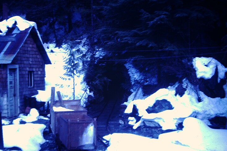
The largest metal mine on the west side of the cascades, as well as one of the few profitable ones. Most of the production occured in the late 1920's, but the mine was developed into the 1950s. The mine produced around 13,000,000 lbs of copper from ore assaying an average of 2.5% Cu.
The primary ore minerals were Chalcopyrite and Bornite.
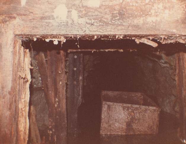
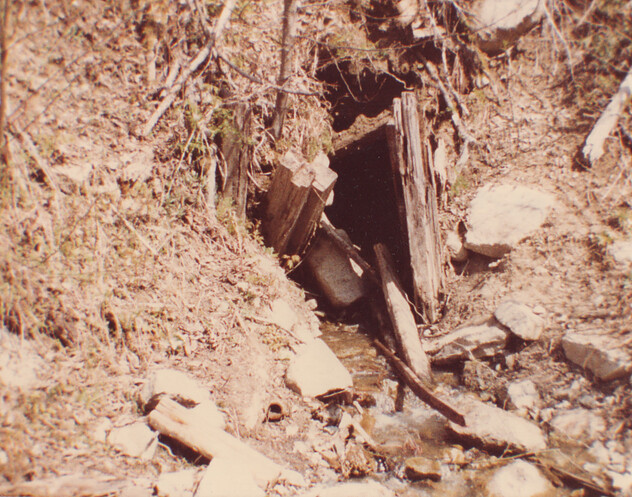
Development consisted of around 12,000' of workings on 5 levels.
Structure: Wnw-Trending Fracture Zone.
Alteration: Weak Potassic, Sericitic, Chloritic
Tectonics: Accreted Terranes Overprinted By Cascade Volcanic Arc
Deposit: 5 shear zones a few inches to 16 ft wide with ore forming lenses, disseminations, replacements, and fracture fillings grant may be suggesting that the district has the potential for a porphyry copper, but none has yet been found. In that case, this deposit would be one of the associated vein deposits ; info.src : 1 pub lit mrds records w017894, us53033 have been merged with this record and deleted
Deposit type: Polymetallic veins
Development: Property idle since 1946
Geology: The dikes and quartzite that are present on the property but do not have a direct association with ore
Rock formation(s): Index Batholith;Index Batholith
Ore(s): Shear Zone
Select Mineral List Type
Standard Detailed Gallery Strunz Chemical ElementsCommodity List
This is a list of exploitable or exploited mineral commodities recorded at this locality.Mineral List
14 valid minerals.
Rock Types Recorded
Note: data is currently VERY limited. Please bear with us while we work towards adding this information!
Select Rock List Type
Alphabetical List Tree DiagramDetailed Mineral List:
| ⓘ Bornite Formula: Cu5FeS4 |
| ⓘ Calcite Formula: CaCO3 |
| ⓘ Chalcocite Formula: Cu2S |
| ⓘ Chalcopyrite Formula: CuFeS2 |
| ⓘ 'Chlorite Group' |
| ⓘ Copper Formula: Cu |
| ⓘ Covellite Formula: CuS |
| ⓘ Cuprite Formula: Cu2O |
| ⓘ Kaolinite Formula: Al2(Si2O5)(OH)4 |
| ⓘ Marcasite Formula: FeS2 |
| ⓘ Molybdenite Formula: MoS2 |
| ⓘ Pyrite Formula: FeS2 |
| ⓘ Quartz Formula: SiO2 |
| ⓘ 'Serpentine Subgroup' Formula: D3[Si2O5](OH)4 |
| ⓘ Silver Formula: Ag |
| ⓘ Talc Formula: Mg3Si4O10(OH)2 |

List of minerals arranged by Strunz 10th Edition classification
| Group 1 - Elements | |||
|---|---|---|---|
| ⓘ | Copper | 1.AA.05 | Cu |
| ⓘ | Silver | 1.AA.05 | Ag |
| Group 2 - Sulphides and Sulfosalts | |||
| ⓘ | Chalcocite | 2.BA.05 | Cu2S |
| ⓘ | Bornite | 2.BA.15 | Cu5FeS4 |
| ⓘ | Covellite | 2.CA.05a | CuS |
| ⓘ | Chalcopyrite | 2.CB.10a | CuFeS2 |
| ⓘ | Molybdenite | 2.EA.30 | MoS2 |
| ⓘ | Pyrite | 2.EB.05a | FeS2 |
| ⓘ | Marcasite | 2.EB.10a | FeS2 |
| Group 4 - Oxides and Hydroxides | |||
| ⓘ | Cuprite | 4.AA.10 | Cu2O |
| ⓘ | Quartz | 4.DA.05 | SiO2 |
| Group 5 - Nitrates and Carbonates | |||
| ⓘ | Calcite | 5.AB.05 | CaCO3 |
| Group 9 - Silicates | |||
| ⓘ | Talc | 9.EC.05 | Mg3Si4O10(OH)2 |
| ⓘ | Kaolinite | 9.ED.05 | Al2(Si2O5)(OH)4 |
| Unclassified | |||
| ⓘ | 'Chlorite Group' | - | |
| ⓘ | 'Serpentine Subgroup' | - | D3[Si2O5](OH)4 |
List of minerals for each chemical element
| H | Hydrogen | |
|---|---|---|
| H | ⓘ Kaolinite | Al2(Si2O5)(OH)4 |
| H | ⓘ Talc | Mg3Si4O10(OH)2 |
| H | ⓘ Serpentine Subgroup | D3[Si2O5](OH)4 |
| C | Carbon | |
| C | ⓘ Calcite | CaCO3 |
| O | Oxygen | |
| O | ⓘ Calcite | CaCO3 |
| O | ⓘ Cuprite | Cu2O |
| O | ⓘ Kaolinite | Al2(Si2O5)(OH)4 |
| O | ⓘ Quartz | SiO2 |
| O | ⓘ Talc | Mg3Si4O10(OH)2 |
| O | ⓘ Serpentine Subgroup | D3[Si2O5](OH)4 |
| Mg | Magnesium | |
| Mg | ⓘ Talc | Mg3Si4O10(OH)2 |
| Al | Aluminium | |
| Al | ⓘ Kaolinite | Al2(Si2O5)(OH)4 |
| Si | Silicon | |
| Si | ⓘ Kaolinite | Al2(Si2O5)(OH)4 |
| Si | ⓘ Quartz | SiO2 |
| Si | ⓘ Talc | Mg3Si4O10(OH)2 |
| Si | ⓘ Serpentine Subgroup | D3[Si2O5](OH)4 |
| S | Sulfur | |
| S | ⓘ Bornite | Cu5FeS4 |
| S | ⓘ Chalcopyrite | CuFeS2 |
| S | ⓘ Chalcocite | Cu2S |
| S | ⓘ Covellite | CuS |
| S | ⓘ Marcasite | FeS2 |
| S | ⓘ Molybdenite | MoS2 |
| S | ⓘ Pyrite | FeS2 |
| Ca | Calcium | |
| Ca | ⓘ Calcite | CaCO3 |
| Fe | Iron | |
| Fe | ⓘ Bornite | Cu5FeS4 |
| Fe | ⓘ Chalcopyrite | CuFeS2 |
| Fe | ⓘ Marcasite | FeS2 |
| Fe | ⓘ Pyrite | FeS2 |
| Cu | Copper | |
| Cu | ⓘ Bornite | Cu5FeS4 |
| Cu | ⓘ Chalcopyrite | CuFeS2 |
| Cu | ⓘ Chalcocite | Cu2S |
| Cu | ⓘ Covellite | CuS |
| Cu | ⓘ Cuprite | Cu2O |
| Cu | ⓘ Copper | Cu |
| Mo | Molybdenum | |
| Mo | ⓘ Molybdenite | MoS2 |
| Ag | Silver | |
| Ag | ⓘ Silver | Ag |
Other Databases
| Link to USGS MRDS: | 10042375 |
|---|
Other Regions, Features and Areas containing this locality
North AmericaContinent
- Cascade RangeMountain Range
North America PlateTectonic Plate
- Cascade ArcVolcanic Arc
- Franciscan DomainDomain
This page contains all mineral locality references listed on mindat.org. This does not claim to be a complete list. If you know of more minerals from this site, please register so you can add to our database. This locality information is for reference purposes only. You should never attempt to
visit any sites listed in mindat.org without first ensuring that you have the permission of the land and/or mineral rights holders
for access and that you are aware of all safety precautions necessary.

Sunset Mine, Trout Creek, Index Mining District, Snohomish County, Washington, USA