Log In


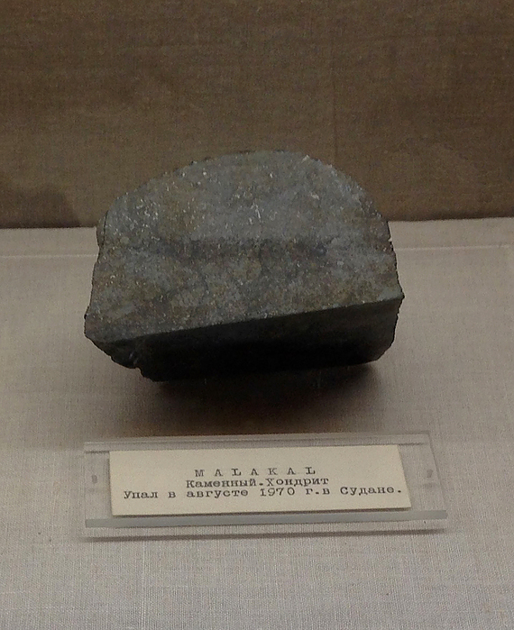
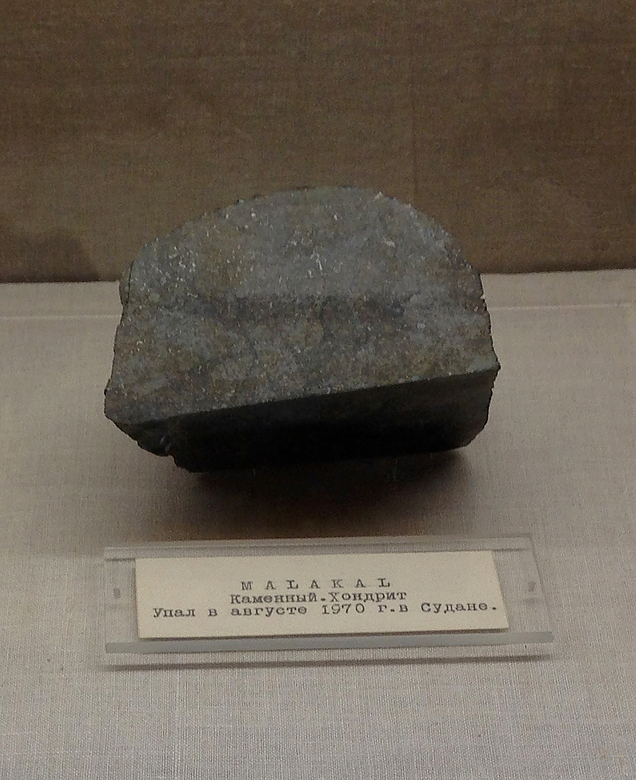
Malakal meteorite, Malakal, Upper Nile, South Sudani
| Regional Level Types | |
|---|---|
| Malakal meteorite | Meteorite Fall Location |
| Malakal | City |
| Upper Nile | State |
| South Sudan | Country |
This page is currently not sponsored. Click here to sponsor this page.
Latitude & Longitude (WGS84):
9° 30' North , 31° 45' East
Latitude & Longitude (decimal):
Meteorite Class:
Meteoritical Society Class:
Köppen climate type:
Nearest Settlements:
| Place | Population | Distance |
|---|---|---|
| Malakal | 160,765 (2017) | 10.5km |
Official name: Malakal
Observed fall: yes.
Fall: 1970, August (probably fell between August 10 and August 15).
Coordinates (Catalogue of Meteorites; Meteoritical Bulletin No.50, June 1971): 9°30' N, 31°45' E
Recovered weight: 2 kg.
Stony. Olivine-hypersthene chondrite, type L5
Soldiers heard or saw something fall from the sky and believed that they were being shot at. On inspection, they found only a rock that was eventually taken to the Geology Department of the University of Khartoum, where it was identified as a meteorite. The specimen reached Khartoum on August 15, 1970, with a report that it had fallen a "few days" previously. It probably fell between August 10 and August 15, 1970.
Select Mineral List Type
Standard Detailed Gallery Strunz Chemical ElementsMineral List
2 valid minerals.
Meteorite/Rock Types Recorded
Note: data is currently VERY limited. Please bear with us while we work towards adding this information!
Select Rock List Type
Alphabetical List Tree DiagramDetailed Mineral List:
| ⓘ Forsterite Formula: Mg2SiO4 References: |
| ⓘ 'Hypersthene' Formula: (Mg,Fe)SiO3 |
| ⓘ 'Nickel-iron' |
| ⓘ 'Orthopyroxene Subgroup' |
| ⓘ Troilite Formula: FeS |
Gallery:
List of minerals arranged by Strunz 10th Edition classification
| Group 2 - Sulphides and Sulfosalts | |||
|---|---|---|---|
| ⓘ | Troilite | 2.CC.10 | FeS |
| Group 9 - Silicates | |||
| ⓘ | Forsterite | 9.AC.05 | Mg2SiO4 |
| Unclassified | |||
| ⓘ | 'Hypersthene' | - | (Mg,Fe)SiO3 |
| ⓘ | 'Orthopyroxene Subgroup' | - | |
| ⓘ | 'Nickel-iron' | - | |
List of minerals for each chemical element
| O | Oxygen | |
|---|---|---|
| O | ⓘ Forsterite | Mg2SiO4 |
| O | ⓘ Hypersthene | (Mg,Fe)SiO3 |
| Mg | Magnesium | |
| Mg | ⓘ Forsterite | Mg2SiO4 |
| Mg | ⓘ Hypersthene | (Mg,Fe)SiO3 |
| Si | Silicon | |
| Si | ⓘ Forsterite | Mg2SiO4 |
| Si | ⓘ Hypersthene | (Mg,Fe)SiO3 |
| S | Sulfur | |
| S | ⓘ Troilite | FeS |
| Fe | Iron | |
| Fe | ⓘ Hypersthene | (Mg,Fe)SiO3 |
| Fe | ⓘ Troilite | FeS |
Other Databases
| Wikipedia: | https://ru.wikipedia.org/wiki/Malakal_(%D0%BC%D0%B5%D1%82%D0%B5%D0%BE%D1%80%D0%B8%D1%82) |
|---|---|
| Wikidata ID: | Q4043647 |
Other Regions, Features and Areas containing this locality
AfricaContinent
African PlateTectonic Plate
- Melut Rift basinBasin
- Sahara Metacraton
- Tshiluba ProvinceBack-arc Basin
This page contains all mineral locality references listed on mindat.org. This does not claim to be a complete list. If you know of more minerals from this site, please register so you can add to our database. This locality information is for reference purposes only. You should never attempt to
visit any sites listed in mindat.org without first ensuring that you have the permission of the land and/or mineral rights holders
for access and that you are aware of all safety precautions necessary.

Malakal meteorite, Malakal, Upper Nile, South Sudan