Log In


Forest City Basin, North America Platei
| Regional Level Types | |
|---|---|
| Forest City Basin | Basin |
| North America Plate | Tectonic Plate |
This page is currently not sponsored. Click here to sponsor this page.



Type:
Largest Settlements:
| Place | Population |
|---|---|
| Olathe | 134,305 (2017) |
| Topeka | 127,265 (2017) |
| Lawrence | 93,917 (2017) |
| Saint Joseph | 76,780 (2017) |
| Leavenworth | 35,980 (2017) |
| Gardner | 20,868 (2017) |
Clubs in region:
The Forest City Basin is a medium Paleozoic sag basin in northeastern Kansas, southeastern Nebraska, northwestern Missouri, and southwestern Iowa. It is bordered on the west by the Nemaha Ridge, on the north by closing contours coming off of the Precambrian structural high in southern Minnesota and eastern South Dakota, on the east by closing contours coming off of the Mississippi River Arch, and on the south by the Bourbon Arch.
Select Mineral List Type
Standard Detailed Gallery Strunz Chemical ElementsCommodity List
This is a list of exploitable or exploited mineral commodities recorded from this region.Mineral List
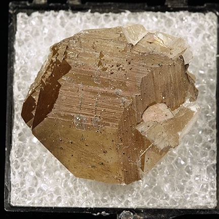
Mineral list contains entries from the region specified including sub-localities23 valid minerals.
Rock Types Recorded
Note: data is currently VERY limited. Please bear with us while we work towards adding this information!
Rock list contains entries from the region specified including sub-localities
Select Rock List Type
Alphabetical List Tree DiagramDetailed Mineral List:
| ⓘ Aragonite Formula: CaCO3 |
| ⓘ Baryte Formula: BaSO4 |
| ⓘ Calcite Formula: CaCO3 Localities: Reported from at least 10 localities in this region. |
| ⓘ Celestine Formula: SrSO4 Localities: Colour: pink |
| ⓘ Chalcopyrite Formula: CuFeS2 |
| ⓘ Chromite Formula: Fe2+Cr3+2O4 |
| ⓘ Diopside Formula: CaMgSi2O6 |
| ⓘ Dolomite Formula: CaMg(CO3)2 |
| ⓘ 'Fayalite-Forsterite Series' |
| ⓘ Galena Formula: PbS |
| ⓘ Halotrichite Formula: FeAl2(SO4)4 · 22H2O |
| ⓘ Ilmenite Formula: Fe2+TiO3 |
| ⓘ Isocubanite Formula: CuFe2S3 |
| ⓘ Kaolinite Formula: Al2(Si2O5)(OH)4 References: |
| ⓘ 'Limonite' |
| ⓘ Mackinawite Formula: FeS |
| ⓘ Marcasite Formula: FeS2 |
| ⓘ Native Copper Formula: Cu |
| ⓘ Native Iron Formula: Fe |
| ⓘ Native Iron var. Kamacite Formula: (Fe,Ni) |
| ⓘ 'Orthopyroxene Subgroup' Description: Orthopyroxene composition of Fs24 reported by Mason (1962). |
| ⓘ 'Petroleum var. Bitumen' Locality: Miami County, Kansas, USA |
| ⓘ 'Plagioclase' Formula: (Na,Ca)[(Si,Al)AlSi2]O8 Description: Plagioclase composition(~An10) |
| ⓘ 'Plessite' |
| ⓘ Pyrite Formula: FeS2 |
| ⓘ 'Pyroxene Group' Formula: ADSi2O6 |
| ⓘ Quartz Formula: SiO2 |
| ⓘ Quartz var. Agate Formula: SiO2 |
| ⓘ Quartz var. Chalcedony Formula: SiO2 |
| ⓘ Quartz var. Lake Superior Agate Formula: SiO2 |
| ⓘ Sphalerite Formula: ZnS Localities: Reported from at least 8 localities in this region. |
| ⓘ Taenite Formula: (Fe,Ni) |
| ⓘ Troilite Formula: FeS |
| ⓘ Vesuvianite Formula: Ca19Fe3+Al4(Al6Mg2)(◻4)◻[Si2O7]4[(SiO4)10]O(OH)9 Locality: Helena, Andrew County, Missouri, USA References: |

List of minerals arranged by Strunz 10th Edition classification
| Group 1 - Elements | |||
|---|---|---|---|
| ⓘ | Native Copper | 1.AA.05 | Cu |
| ⓘ | Native Iron | 1.AE.05 | Fe |
| ⓘ | var. Kamacite | 1.AE.05 | (Fe,Ni) |
| ⓘ | Taenite | 1.AE.10 | (Fe,Ni) |
| Group 2 - Sulphides and Sulfosalts | |||
| ⓘ | Sphalerite | 2.CB.05a | ZnS |
| ⓘ | Chalcopyrite | 2.CB.10a | CuFeS2 |
| ⓘ | Isocubanite | 2.CB.55b | CuFe2S3 |
| ⓘ | Troilite | 2.CC.10 | FeS |
| ⓘ | Mackinawite | 2.CC.25 | FeS |
| ⓘ | Galena | 2.CD.10 | PbS |
| ⓘ | Pyrite | 2.EB.05a | FeS2 |
| ⓘ | Marcasite | 2.EB.10a | FeS2 |
| Group 4 - Oxides and Hydroxides | |||
| ⓘ | Chromite | 4.BB.05 | Fe2+Cr3+2O4 |
| ⓘ | Ilmenite | 4.CB.05 | Fe2+TiO3 |
| ⓘ | Quartz var. Agate | 4.DA.05 | SiO2 |
| ⓘ | var. Chalcedony | 4.DA.05 | SiO2 |
| ⓘ | 4.DA.05 | SiO2 | |
| ⓘ | var. Lake Superior Agate | 4.DA.05 | SiO2 |
| Group 5 - Nitrates and Carbonates | |||
| ⓘ | Calcite | 5.AB.05 | CaCO3 |
| ⓘ | Dolomite | 5.AB.10 | CaMg(CO3)2 |
| ⓘ | Aragonite | 5.AB.15 | CaCO3 |
| Group 7 - Sulphates, Chromates, Molybdates and Tungstates | |||
| ⓘ | Baryte | 7.AD.35 | BaSO4 |
| ⓘ | Celestine | 7.AD.35 | SrSO4 |
| ⓘ | Halotrichite | 7.CB.85 | FeAl2(SO4)4 · 22H2O |
| Group 9 - Silicates | |||
| ⓘ | Vesuvianite | 9.BG.35 | Ca19Fe3+Al4(Al6Mg2)(◻4)◻[Si2O7]4[(SiO4)10]O(OH)9 |
| ⓘ | Diopside | 9.DA.15 | CaMgSi2O6 |
| ⓘ | Kaolinite | 9.ED.05 | Al2(Si2O5)(OH)4 |
| Unclassified | |||
| ⓘ | 'Limonite' | - | |
| ⓘ | 'Fayalite-Forsterite Series' | - | |
| ⓘ | 'Plagioclase' | - | (Na,Ca)[(Si,Al)AlSi2]O8 |
| ⓘ | 'Petroleum var. Bitumen' | - | |
| ⓘ | 'Pyroxene Group' | - | ADSi2O6 |
| ⓘ | 'Plessite' | - | |
| ⓘ | 'Orthopyroxene Subgroup' | - | |
List of minerals for each chemical element
| H | Hydrogen | |
|---|---|---|
| H | ⓘ Halotrichite | FeAl2(SO4)4 · 22H2O |
| H | ⓘ Kaolinite | Al2(Si2O5)(OH)4 |
| H | ⓘ Vesuvianite | Ca19Fe3+Al4(Al6Mg2)(◻4)◻[Si2O7]4[(SiO4)10]O(OH)9 |
| C | Carbon | |
| C | ⓘ Aragonite | CaCO3 |
| C | ⓘ Calcite | CaCO3 |
| C | ⓘ Dolomite | CaMg(CO3)2 |
| O | Oxygen | |
| O | ⓘ Quartz var. Agate | SiO2 |
| O | ⓘ Aragonite | CaCO3 |
| O | ⓘ Baryte | BaSO4 |
| O | ⓘ Calcite | CaCO3 |
| O | ⓘ Celestine | SrSO4 |
| O | ⓘ Quartz var. Chalcedony | SiO2 |
| O | ⓘ Chromite | Fe2+Cr23+O4 |
| O | ⓘ Diopside | CaMgSi2O6 |
| O | ⓘ Dolomite | CaMg(CO3)2 |
| O | ⓘ Halotrichite | FeAl2(SO4)4 · 22H2O |
| O | ⓘ Ilmenite | Fe2+TiO3 |
| O | ⓘ Kaolinite | Al2(Si2O5)(OH)4 |
| O | ⓘ Quartz | SiO2 |
| O | ⓘ Vesuvianite | Ca19Fe3+Al4(Al6Mg2)(◻4)◻[Si2O7]4[(SiO4)10]O(OH)9 |
| O | ⓘ Fayalite-Forsterite Series | |
| O | ⓘ Quartz var. Lake Superior Agate | SiO2 |
| O | ⓘ Plagioclase | (Na,Ca)[(Si,Al)AlSi2]O8 |
| O | ⓘ Pyroxene Group | ADSi2O6 |
| Na | Sodium | |
| Na | ⓘ Plagioclase | (Na,Ca)[(Si,Al)AlSi2]O8 |
| Mg | Magnesium | |
| Mg | ⓘ Diopside | CaMgSi2O6 |
| Mg | ⓘ Dolomite | CaMg(CO3)2 |
| Mg | ⓘ Vesuvianite | Ca19Fe3+Al4(Al6Mg2)(◻4)◻[Si2O7]4[(SiO4)10]O(OH)9 |
| Mg | ⓘ Fayalite-Forsterite Series | |
| Al | Aluminium | |
| Al | ⓘ Halotrichite | FeAl2(SO4)4 · 22H2O |
| Al | ⓘ Kaolinite | Al2(Si2O5)(OH)4 |
| Al | ⓘ Vesuvianite | Ca19Fe3+Al4(Al6Mg2)(◻4)◻[Si2O7]4[(SiO4)10]O(OH)9 |
| Al | ⓘ Plagioclase | (Na,Ca)[(Si,Al)AlSi2]O8 |
| Si | Silicon | |
| Si | ⓘ Quartz var. Agate | SiO2 |
| Si | ⓘ Quartz var. Chalcedony | SiO2 |
| Si | ⓘ Diopside | CaMgSi2O6 |
| Si | ⓘ Kaolinite | Al2(Si2O5)(OH)4 |
| Si | ⓘ Quartz | SiO2 |
| Si | ⓘ Vesuvianite | Ca19Fe3+Al4(Al6Mg2)(◻4)◻[Si2O7]4[(SiO4)10]O(OH)9 |
| Si | ⓘ Fayalite-Forsterite Series | |
| Si | ⓘ Quartz var. Lake Superior Agate | SiO2 |
| Si | ⓘ Plagioclase | (Na,Ca)[(Si,Al)AlSi2]O8 |
| Si | ⓘ Pyroxene Group | ADSi2O6 |
| S | Sulfur | |
| S | ⓘ Baryte | BaSO4 |
| S | ⓘ Celestine | SrSO4 |
| S | ⓘ Chalcopyrite | CuFeS2 |
| S | ⓘ Galena | PbS |
| S | ⓘ Halotrichite | FeAl2(SO4)4 · 22H2O |
| S | ⓘ Isocubanite | CuFe2S3 |
| S | ⓘ Mackinawite | FeS |
| S | ⓘ Marcasite | FeS2 |
| S | ⓘ Pyrite | FeS2 |
| S | ⓘ Sphalerite | ZnS |
| S | ⓘ Troilite | FeS |
| Ca | Calcium | |
| Ca | ⓘ Aragonite | CaCO3 |
| Ca | ⓘ Calcite | CaCO3 |
| Ca | ⓘ Diopside | CaMgSi2O6 |
| Ca | ⓘ Dolomite | CaMg(CO3)2 |
| Ca | ⓘ Vesuvianite | Ca19Fe3+Al4(Al6Mg2)(◻4)◻[Si2O7]4[(SiO4)10]O(OH)9 |
| Ca | ⓘ Plagioclase | (Na,Ca)[(Si,Al)AlSi2]O8 |
| Ti | Titanium | |
| Ti | ⓘ Ilmenite | Fe2+TiO3 |
| Cr | Chromium | |
| Cr | ⓘ Chromite | Fe2+Cr23+O4 |
| Fe | Iron | |
| Fe | ⓘ Chalcopyrite | CuFeS2 |
| Fe | ⓘ Chromite | Fe2+Cr23+O4 |
| Fe | ⓘ Halotrichite | FeAl2(SO4)4 · 22H2O |
| Fe | ⓘ Ilmenite | Fe2+TiO3 |
| Fe | ⓘ Native Iron | Fe |
| Fe | ⓘ Isocubanite | CuFe2S3 |
| Fe | ⓘ Native Iron var. Kamacite | (Fe,Ni) |
| Fe | ⓘ Mackinawite | FeS |
| Fe | ⓘ Marcasite | FeS2 |
| Fe | ⓘ Pyrite | FeS2 |
| Fe | ⓘ Taenite | (Fe,Ni) |
| Fe | ⓘ Troilite | FeS |
| Fe | ⓘ Vesuvianite | Ca19Fe3+Al4(Al6Mg2)(◻4)◻[Si2O7]4[(SiO4)10]O(OH)9 |
| Fe | ⓘ Fayalite-Forsterite Series | |
| Ni | Nickel | |
| Ni | ⓘ Native Iron var. Kamacite | (Fe,Ni) |
| Ni | ⓘ Taenite | (Fe,Ni) |
| Cu | Copper | |
| Cu | ⓘ Chalcopyrite | CuFeS2 |
| Cu | ⓘ Native Copper | Cu |
| Cu | ⓘ Isocubanite | CuFe2S3 |
| Zn | Zinc | |
| Zn | ⓘ Sphalerite | ZnS |
| Sr | Strontium | |
| Sr | ⓘ Celestine | SrSO4 |
| Ba | Barium | |
| Ba | ⓘ Baryte | BaSO4 |
| Pb | Lead | |
| Pb | ⓘ Galena | PbS |
Fossils
There are 174 fossil localities from the PaleoBioDB database within this region.These data are provided on an experimental basis and are taken from external databases. Mindat.org has no control currently over the accuracy of these data.
| Occurrences | 1626 |
|---|---|
| Youngest Fossil Listed | 0.01 Ma (Pleistocene) |
| Oldest Fossil Listed | 323 Ma (Carboniferous) |
| Stratigraphic Units | Click here to view 115 stratigraphic units. |
| Fossils from Region | Click here to show the list. |
| Fossil Localities | Click to show 174 fossil localities |


- Iowa
- Kansas
- Anderson County
- Brown County
- Carboniferous🐚 Bellevue
- Carboniferous🐚 BRH2N-5
- Carboniferous🐚 Creek west of Hiawatha
- Carboniferous🐚 Robinson Locality
- Paleozoic🐚 USGS Loc. 13427
- Carboniferous🐚 USGS Loc. 13429
- Carboniferous🐚 USGS Loc. 13430
- Carboniferous🐚 USGS Loc. 13432
- Carboniferous🐚 USGS Loc. 13437
- Paleozoic🐚 USGS Loc. 13634
- Carboniferous🐚 USGS Loc. 14908
- Carboniferous🐚 USGS Loc. 14909
- Carboniferous🐚 USGS Loc. 14912
- Carboniferous🐚 USGS Loc. 14928
- Doniphan County
- Douglas County
- Carboniferous🐚 1 mile north of Baldwin
- Carboniferous🐚 Baldwin
- Carboniferous🐚 Between Lawrence and Baldwin
- Carboniferous🐚 Clinton Lake emergency spillway
- Carboniferous🐚 Douglas County near Lawrence
- Carboniferous🐚 Haverkampf farm
- Carboniferous🐚 KSGS 4716 - Baldwin [Vinland Shale]
- Carboniferous🐚 Lawrence
- Carboniferous🐚 Lone Star Lake
- Carboniferous🐚 Lone Star Lake spillway
- Carboniferous🐚 NE of Eudora
- Carboniferous🐚 Near Baldwin
- Pleistocene🐚 North Lawrence
- Carboniferous🐚 Old fair ground
- Carboniferous🐚 Pleasant Grove KS
- Carboniferous🐚 Quarry near bridge on Route 10
- Carboniferous🐚 Road cut just north of I-70
- Carboniferous🐚 US Highway 40
- Franklin County
- Jackson County
- Paleozoic🐚 JASC-7
- Carboniferous🐚 PTDU-2
- Carboniferous🐚 USGS Loc. 13592
- Paleozoic🐚 USGS Loc. 13608
- Carboniferous🐚 USGS Loc. 13639
- Carboniferous🐚 USGS Loc. 13646
- Carboniferous🐚 USGS Loc. 13648
- Carboniferous🐚 USGS Loc. 13652
- Carboniferous🐚 USGS Loc. 13654
- Carboniferous🐚 USGS Loc. 13655
- Paleozoic🐚 USGS Loc. 13657
- Paleozoic🐚 USGS Loc. 13658
- Paleozoic🐚 USGS Loc. 13660
- Carboniferous🐚 USGS Loc. 14913
- Carboniferous🐚 USGS Loc. 14938
- Jefferson County
- Johnson County
- Leavenworth County
- Carboniferous🐚 Highway 32 west of Linwood
- Carboniferous🐚 Highway 40
- Carboniferous🐚 Leavenworth
- Carboniferous🐚 Nine Mile School
- Paleozoic🐚 PTEM-2
- Carboniferous🐚 Railroad cut east of Linwood
- Carboniferous🐚 South of Missouri River bridge
- Carboniferous🐚 Station 189. Road east of creek. East part of sec. 6
- Carboniferous🐚 Tonganoxie Lake
- Carboniferous🐚 West of Bonner Springs
- Linn County
- Lyon County
- Kansas
- Lyon County
- Miami County
- Nemaha County
- Osage County
- Pottawatomie County
- Shawnee County
- Carboniferous🐚 0.25 mile west of District No. 38 school
- Carboniferous🐚 6 miles S by SW of Topeka
- Carboniferous🐚 Aarde member Shawnee Kansas 42
- Carboniferous🐚 Brick plant cut in field
- Carboniferous🐚 Burlingame road
- Carboniferous🐚 Burlingame-Auburn road
- Carboniferous🐚 East 17 street and Hudson Blvd
- Pleistocene🐚 Kaw River at North Topeka
- Carboniferous🐚 Loc. 13637
- Carboniferous🐚 Loc. 13687
- Carboniferous🐚 North of Auburn
- Carboniferous🐚 Shriner road just east of Highway 73
- Carboniferous🐚 Topeka
- Carboniferous🐚 USGS Loc. 13635
- Carboniferous🐚 West Topeka brick plant
- Wabaunsee County
- Carboniferous🐚 I70BM-13
- Carboniferous🐚 I70MH-6
- Carboniferous🐚 I70PAX-12
- Carboniferous🐚 I70RW-3
- Carboniferous🐚 I70VR-7
- Carboniferous🐚 KU-WAB-12
- Paleozoic🐚 Speiser formation Wabaunsee Kansas 135
- Carboniferous🐚 USGS Loc. 13438
- Carboniferous🐚 USGS Loc. 13439
- Carboniferous🐚 USGS Loc. 13440
- Carboniferous🐚 USGS Loc. 13443
- Carboniferous🐚 USGS Loc. 13444
- Carboniferous🐚 USGS Loc. 13557
- Carboniferous🐚 USGS Loc. 13562
- Paleozoic🐚 USGS Loc. 13566
- Carboniferous🐚 USGS Loc. 13571
- Carboniferous🐚 USGS Loc. 13589
- Carboniferous🐚 USGS Loc. 13667
- Carboniferous🐚 USGS Loc. 13670
- Carboniferous🐚 USGS Loc. 13672
- Paleozoic🐚 USGS Loc. 13677
- Paleozoic🐚 USGS Loc. 13679
- Carboniferous🐚 USGS Loc. 13684
- Carboniferous🐚 USGS Loc. 13686
- Carboniferous🐚 USGS Loc. 13688
- Carboniferous🐚 USGS Loc. 13690
- Wyandotte County
- Missouri
- Nebraska
Localities in this Region
- Iowa
- Kansas
- Kansas
- ⭔Johnson County
- ⭔Leavenworth County
- Linn County
- ⭔Miami County
- ⭔Osage County
- Pottawatomie County
- ⭔Shawnee County
- ⭔Wabaunsee County
- McFarland
- Missouri
- Andrew County
- Atchison County
- Buchanan County
- Dekalb County
- Nodaway County
- Platte County
- Nebraska
- Nemaha County
- Pawnee County
- Richardson County
Other Regions, Features and Areas that Intersect
North AmericaContinent
North America PlateTectonic Plate
- Great Plains DomainDomain
- Mazatzal DomainDomain
- Mazatzal TerraneVolcanic Arc
- Mid-continent DomainDomain
- Mid-continent RiftNarrow Rift
- Yavapai TerraneVolcanic Arc
USA
- Midcontinent RiftGeologic Province
This page contains all mineral locality references listed on mindat.org. This does not claim to be a complete list. If you know of more minerals from this site, please register so you can add to our database. This locality information is for reference purposes only. You should never attempt to
visit any sites listed in mindat.org without first ensuring that you have the permission of the land and/or mineral rights holders
for access and that you are aware of all safety precautions necessary.
References

Atchison County, Kansas, USA