Log In


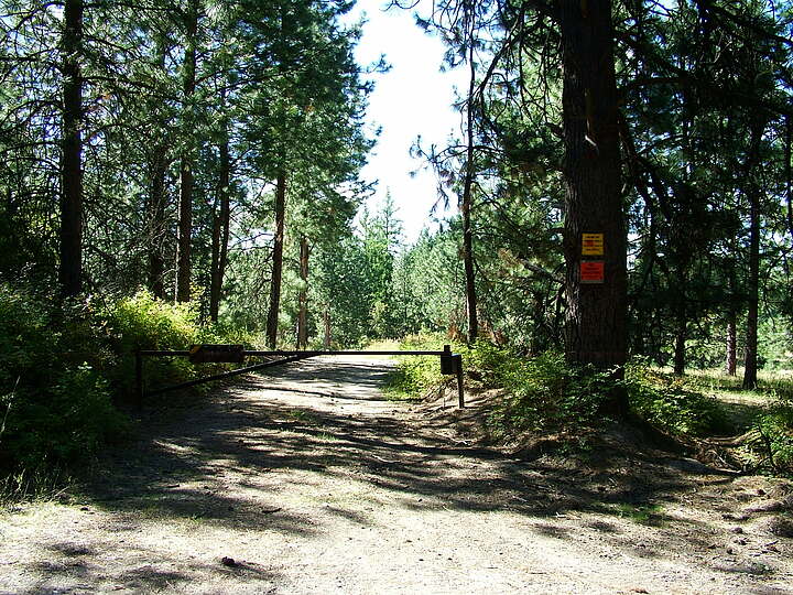
Daybreak Mine, Mount Kit Carson, Spokane County, Washington, USAi
| Regional Level Types | |
|---|---|
| Daybreak Mine | Mine |
| Mount Kit Carson | Mountain |
| Spokane County | County |
| Washington | State |
| USA | Country |
This page is currently not sponsored. Click here to sponsor this page.



Latitude & Longitude (WGS84):
47° 56' 38'' North , 117° 11' 51'' West
Latitude & Longitude (decimal):
Type:
Köppen climate type:
Nearest Settlements:
| Place | Population | Distance |
|---|---|---|
| Green Bluff | 761 (2011) | 14.1km |
| Blanchard | 261 (2011) | 17.8km |
| Deer Park | 3,941 (2017) | 20.8km |
| Hauser | 689 (2017) | 22.9km |
| Mead | 7,275 (2011) | 22.9km |
Nearest Clubs:
Local clubs are the best way to get access to collecting localities
Local clubs are the best way to get access to collecting localities
| Club | Location | Distance |
|---|---|---|
| Pend Oreille Rock and Gem Club | Oldtown, Idaho | 29km |
| Spokane Rock Rollers Club | Spokane Valley, Washington | 30km |
| North Idaho Mineral Club | Coeur d'Alene, Idaho | 43km |
Other/historical names associated with this locality:
Dahl lease; Huffman lease
A U mine located in the E½NE¼ sec. 11, T28N, R44E, WM, 5.1 km (3.17 mi) NW of Mount Kit Carson (coordinates of record) and about 18 miles (ca. 29 km) NE of Spokane, on private land. MRDS database stated accuracy for this location is 500 meters.
Local rocks include Mesozoic granitic rocks, undivided.
Mineralization is veinlets and space-filling in decomposed granite, composing 5 orebodies in an area of 250 feet (ca. 76 m) by 900 feet (ca. 274 m).
Workings include surface openings comprised of an open pit and 7 drill holes as of 1955.
An interesting article (Leo, 1960) describing the colour variations observed in Spokane autunite can be found at the internet link below.
Select Mineral List Type
Standard Detailed Gallery Strunz Chemical ElementsCommodity List
This is a list of exploitable or exploited mineral commodities recorded at this locality.Mineral List
3 valid minerals. 1 (TL) - type locality of valid minerals.
Rock Types Recorded
Note: data is currently VERY limited. Please bear with us while we work towards adding this information!
Select Rock List Type
Alphabetical List Tree DiagramDetailed Mineral List:
| ✪ Autunite Formula: Ca(UO2)2(PO4)2 · 10-12H2O Habit: platelike clusters and sheafs to over 1.5" and groups over 1' across Colour: bright yellow to deep green |
| ⓘ Meta-autunite (TL) Formula: Ca(UO2)2(PO4)2 · 6H2O Type Locality: |
| ⓘ Uraninite Formula: UO2 |

List of minerals arranged by Strunz 10th Edition classification
| Group 4 - Oxides and Hydroxides | |||
|---|---|---|---|
| ⓘ | Uraninite | 4.DL.05 | UO2 |
| Group 8 - Phosphates, Arsenates and Vanadates | |||
| ⓘ | Autunite | 8.EB.05 | Ca(UO2)2(PO4)2 · 10-12H2O |
| ⓘ | Meta-autunite (TL) | 8.EB.10 | Ca(UO2)2(PO4)2 · 6H2O |
List of minerals for each chemical element
| H | Hydrogen | |
|---|---|---|
| H | ⓘ Autunite | Ca(UO2)2(PO4)2 · 10-12H2O |
| H | ⓘ Meta-autunite | Ca(UO2)2(PO4)2 · 6H2O |
| O | Oxygen | |
| O | ⓘ Autunite | Ca(UO2)2(PO4)2 · 10-12H2O |
| O | ⓘ Meta-autunite | Ca(UO2)2(PO4)2 · 6H2O |
| O | ⓘ Uraninite | UO2 |
| P | Phosphorus | |
| P | ⓘ Autunite | Ca(UO2)2(PO4)2 · 10-12H2O |
| P | ⓘ Meta-autunite | Ca(UO2)2(PO4)2 · 6H2O |
| Ca | Calcium | |
| Ca | ⓘ Autunite | Ca(UO2)2(PO4)2 · 10-12H2O |
| Ca | ⓘ Meta-autunite | Ca(UO2)2(PO4)2 · 6H2O |
| U | Uranium | |
| U | ⓘ Autunite | Ca(UO2)2(PO4)2 · 10-12H2O |
| U | ⓘ Meta-autunite | Ca(UO2)2(PO4)2 · 6H2O |
| U | ⓘ Uraninite | UO2 |
Other Databases
| Link to USGS MRDS: | 10253453 |
|---|
Other Regions, Features and Areas containing this locality
North AmericaContinent
- Columbia MountainsMountain Range
North America PlateTectonic Plate
- Antler Foreland BasinBasin
- Belt BasinBasin
- Pend Oreille DomainDomain
This page contains all mineral locality references listed on mindat.org. This does not claim to be a complete list. If you know of more minerals from this site, please register so you can add to our database. This locality information is for reference purposes only. You should never attempt to
visit any sites listed in mindat.org without first ensuring that you have the permission of the land and/or mineral rights holders
for access and that you are aware of all safety precautions necessary.

Daybreak Mine, Mount Kit Carson, Spokane County, Washington, USA