Log In


Snaefell Mine, Lonan, Garff, Isle of Mani
| Regional Level Types | |
|---|---|
| Snaefell Mine | Mine |
| Lonan | Parish |
| Garff | Sheading |
| Isle of Man | Crown Dependency |
This page is currently not sponsored. Click here to sponsor this page.


Latitude & Longitude (WGS84):
54° 15' 23'' North , 4° 26' 39'' West
Latitude & Longitude (decimal):
Type:
Köppen climate type:
Nearest Settlements:
| Place | Population | Distance |
|---|---|---|
| Laxey | 1,768 (2015) | 4.1km |
| Ramsey | 7,309 (2015) | 8.3km |
| Douglas | 26,218 (2018) | 12.1km |
| Peel | 3,781 (2015) | 16.5km |
| Castletown | 3,100 (2015) | 24.4km |
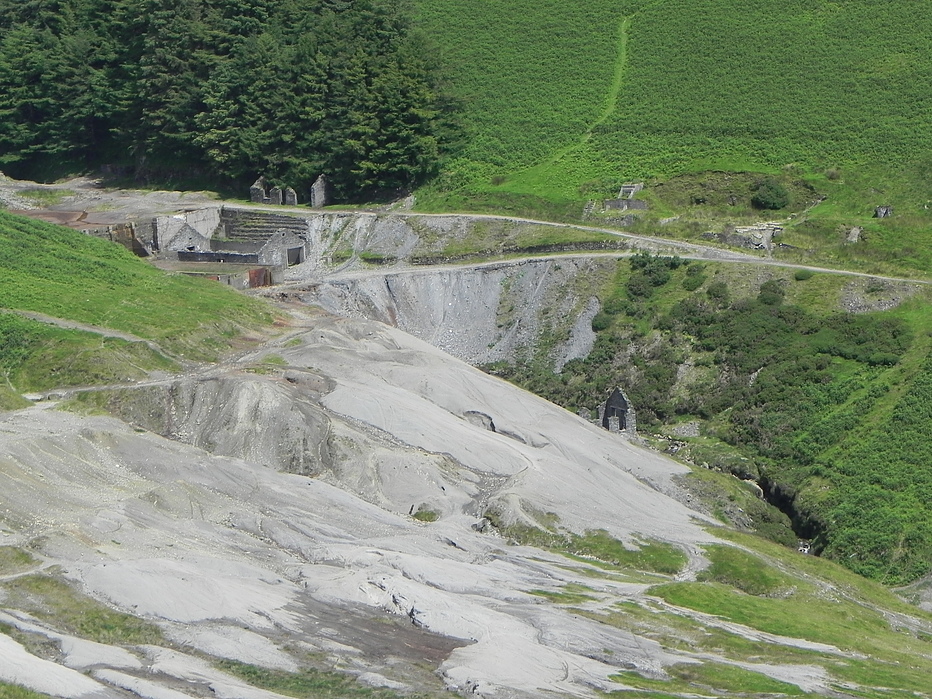
The Great Snaefell Mine, also referred to as the East Snaefell Mine, was a zinc mine located high in the Laxey Valley on the slopes of Snaefell Mountain, in the parish of Lonan, Isle of Man. The mine reached a depth of 1,188 ft (362 m) and is remembered as the scene of the Isle of Man's worst mining disaster in 1897.
Select Mineral List Type
Standard Detailed Gallery Strunz Chemical ElementsCommodity List
This is a list of exploitable or exploited mineral commodities recorded at this locality.Mineral List
7 valid minerals.
Detailed Mineral List:
| ⓘ Chalcopyrite Formula: CuFeS2 |
| ⓘ Galena Formula: PbS |
| ⓘ Graphite Formula: C |
| ⓘ Pyrite Formula: FeS2 |
| ⓘ Pyrrhotite Formula: Fe1-xS |
| ⓘ Rhodochrosite Formula: MnCO3 |
| ⓘ Sphalerite Formula: ZnS |
Gallery:
List of minerals arranged by Strunz 10th Edition classification
| Group 1 - Elements | |||
|---|---|---|---|
| ⓘ | Graphite | 1.CB.05a | C |
| Group 2 - Sulphides and Sulfosalts | |||
| ⓘ | Sphalerite | 2.CB.05a | ZnS |
| ⓘ | Chalcopyrite | 2.CB.10a | CuFeS2 |
| ⓘ | Pyrrhotite | 2.CC.10 | Fe1-xS |
| ⓘ | Galena | 2.CD.10 | PbS |
| ⓘ | Pyrite | 2.EB.05a | FeS2 |
| Group 5 - Nitrates and Carbonates | |||
| ⓘ | Rhodochrosite | 5.AB.05 | MnCO3 |
List of minerals for each chemical element
| C | Carbon | |
|---|---|---|
| C | ⓘ Graphite | C |
| C | ⓘ Rhodochrosite | MnCO3 |
| O | Oxygen | |
| O | ⓘ Rhodochrosite | MnCO3 |
| S | Sulfur | |
| S | ⓘ Chalcopyrite | CuFeS2 |
| S | ⓘ Galena | PbS |
| S | ⓘ Pyrite | FeS2 |
| S | ⓘ Pyrrhotite | Fe1-xS |
| S | ⓘ Sphalerite | ZnS |
| Mn | Manganese | |
| Mn | ⓘ Rhodochrosite | MnCO3 |
| Fe | Iron | |
| Fe | ⓘ Chalcopyrite | CuFeS2 |
| Fe | ⓘ Pyrite | FeS2 |
| Fe | ⓘ Pyrrhotite | Fe1-xS |
| Cu | Copper | |
| Cu | ⓘ Chalcopyrite | CuFeS2 |
| Zn | Zinc | |
| Zn | ⓘ Sphalerite | ZnS |
| Pb | Lead | |
| Pb | ⓘ Galena | PbS |
Other Databases
| Wikipedia: | https://en.wikipedia.org/wiki/Snaefell_Mine |
|---|---|
| Wikidata ID: | Q29025815 |
Other Regions, Features and Areas containing this locality
British and Irish IslesGroup of Islands
Eurasian PlateTectonic Plate
- AvaloniaVolcanic Arc
EuropeContinent
This page contains all mineral locality references listed on mindat.org. This does not claim to be a complete list. If you know of more minerals from this site, please register so you can add to our database. This locality information is for reference purposes only. You should never attempt to
visit any sites listed in mindat.org without first ensuring that you have the permission of the land and/or mineral rights holders
for access and that you are aware of all safety precautions necessary.

Snaefell Mine, Lonan, Garff, Isle of Man