Log In


Inveran Mine, Spiddal, Connemara, Galway County, Connacht, Irelandi
| Regional Level Types | |
|---|---|
| Inveran Mine | Mine |
| Spiddal | Village |
| Connemara | Region |
| Galway County | County |
| Connacht | Province |
| Ireland | Country |
This page is currently not sponsored. Click here to sponsor this page.


Latitude & Longitude (WGS84):
53° 13' 51'' North , 9° 28' 28'' West
Latitude & Longitude (decimal):
Type:
Köppen climate type:
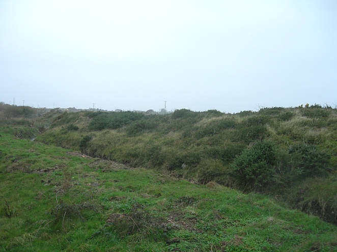
Disturbed ground between airfield and castle, towards coast from Inveran village.
Victorian era workings on fluorite/quartz lode containing galena, pyrite and chalcopyrite mineralization quite common to the South Connemara granites.
The old 6 inch maps record 3 shafts (now capped or flooded) and several adits, the latter no longer visible.
Irish Grid Ref: M015210
Select Mineral List Type
Standard Detailed Gallery Strunz Chemical ElementsDetailed Mineral List:
| ⓘ Baryte Formula: BaSO4 References: |
| ⓘ Chalcopyrite Formula: CuFeS2 References: |
| ⓘ Fluorite Formula: CaF2 |
| ⓘ Galena Formula: PbS References: |
| ⓘ Malachite Formula: Cu2(CO3)(OH)2 References: |
| ⓘ Pyrite Formula: FeS2 References: |
| ⓘ Quartz Formula: SiO2 References: |
Gallery:
List of minerals arranged by Strunz 10th Edition classification
| Group 2 - Sulphides and Sulfosalts | |||
|---|---|---|---|
| ⓘ | Chalcopyrite | 2.CB.10a | CuFeS2 |
| ⓘ | Galena | 2.CD.10 | PbS |
| ⓘ | Pyrite | 2.EB.05a | FeS2 |
| Group 3 - Halides | |||
| ⓘ | Fluorite | 3.AB.25 | CaF2 |
| Group 4 - Oxides and Hydroxides | |||
| ⓘ | Quartz | 4.DA.05 | SiO2 |
| Group 5 - Nitrates and Carbonates | |||
| ⓘ | Malachite | 5.BA.10 | Cu2(CO3)(OH)2 |
| Group 7 - Sulphates, Chromates, Molybdates and Tungstates | |||
| ⓘ | Baryte | 7.AD.35 | BaSO4 |
List of minerals for each chemical element
| H | Hydrogen | |
|---|---|---|
| H | ⓘ Malachite | Cu2(CO3)(OH)2 |
| C | Carbon | |
| C | ⓘ Malachite | Cu2(CO3)(OH)2 |
| O | Oxygen | |
| O | ⓘ Baryte | BaSO4 |
| O | ⓘ Malachite | Cu2(CO3)(OH)2 |
| O | ⓘ Quartz | SiO2 |
| F | Fluorine | |
| F | ⓘ Fluorite | CaF2 |
| Si | Silicon | |
| Si | ⓘ Quartz | SiO2 |
| S | Sulfur | |
| S | ⓘ Baryte | BaSO4 |
| S | ⓘ Chalcopyrite | CuFeS2 |
| S | ⓘ Galena | PbS |
| S | ⓘ Pyrite | FeS2 |
| Ca | Calcium | |
| Ca | ⓘ Fluorite | CaF2 |
| Fe | Iron | |
| Fe | ⓘ Chalcopyrite | CuFeS2 |
| Fe | ⓘ Pyrite | FeS2 |
| Cu | Copper | |
| Cu | ⓘ Chalcopyrite | CuFeS2 |
| Cu | ⓘ Malachite | Cu2(CO3)(OH)2 |
| Ba | Barium | |
| Ba | ⓘ Baryte | BaSO4 |
| Pb | Lead | |
| Pb | ⓘ Galena | PbS |
Other Regions, Features and Areas containing this locality
British and Irish IslesGroup of Islands
Eurasian PlateTectonic Plate
- CaledonidesOrogenic Belt
Ireland (island)Island
This page contains all mineral locality references listed on mindat.org. This does not claim to be a complete list. If you know of more minerals from this site, please register so you can add to our database. This locality information is for reference purposes only. You should never attempt to
visit any sites listed in mindat.org without first ensuring that you have the permission of the land and/or mineral rights holders
for access and that you are aware of all safety precautions necessary.

Inveran Mine, Spiddal, Connemara, Galway County, Connacht, Ireland